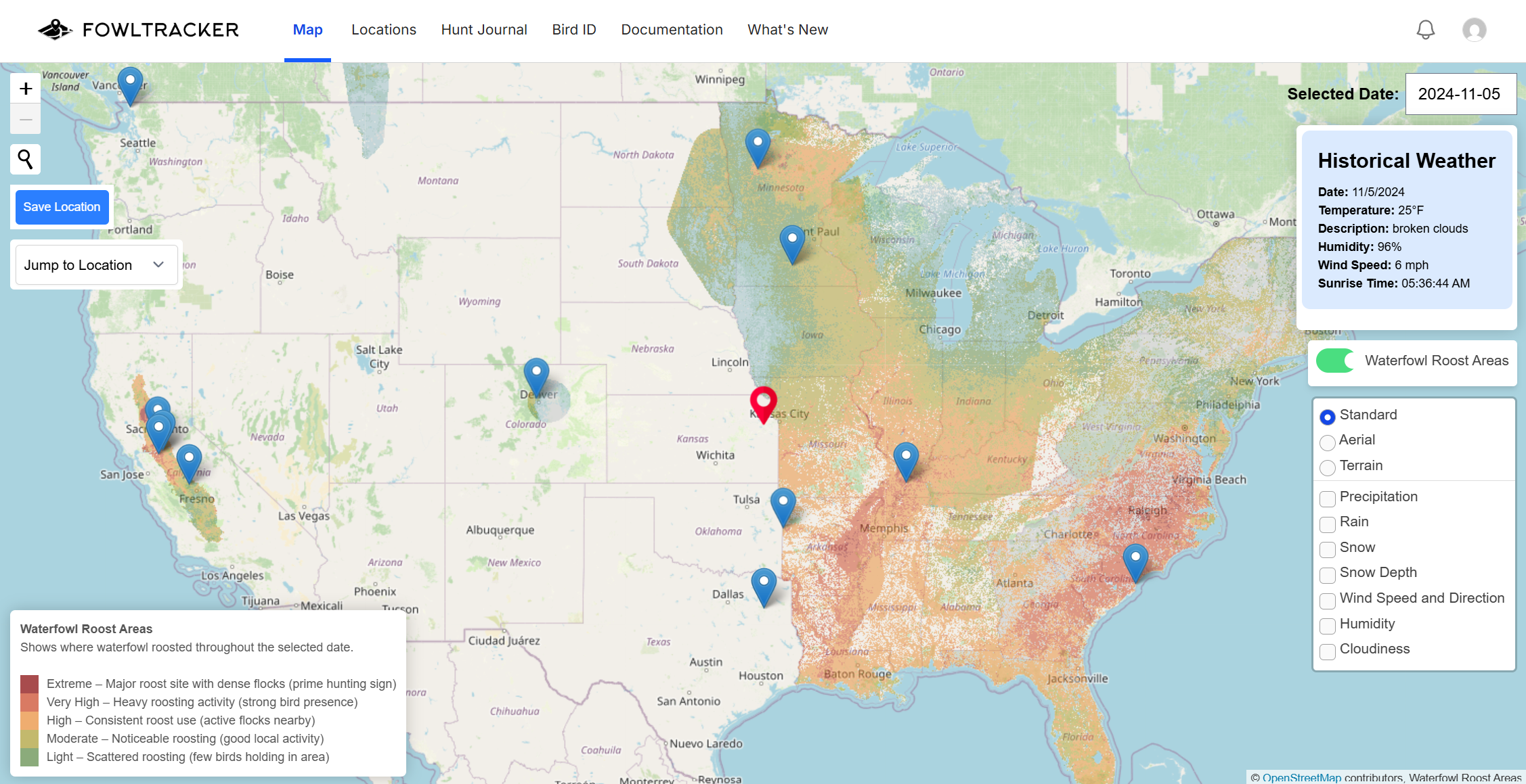
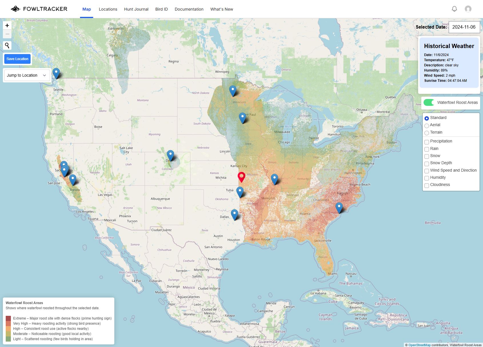
Public Lands: Find Public Ground Birds Have Been Using
New
Hey folks! Two new ways to find public land that's actually been holding birds.
Tap public land on the map Turn on Public land under Layers, zoom in, and tap any refuge, WMA or national forest. The Spots panel shows that unit's roost activity for the date you're looking at: how much of it sat at each level, its hottest part, and how much was Moderate or higher. Public land boundaries now come from the latest USGS PAD-US data.
The Public Lands pagePublic Lands in the top navigation lists the public land in a state with the most recent roost reading for each unit. Search by name, filter by type, reading and public access, and sort by roost activity, name, size or most recently read. View on map takes you straight to the unit.
The list is free for everyone; roost readings on it are part of Premium. Free plans can tap public land on the map for the 1st of each month.
Public access isn't the same as hunting access — always check the regulations before you go. More in the docs: Using Public Lands (link: https://app.fowltracker.com/docs/public_lands).
Let us know what you think!
FowlTracker Got a Major Overhaul This Offseason
New
Hey folks! Season's about here, and FowlTracker doesn't look much like the app you left in January. We spent the whole offseason rebuilding it. Here's the short version.
A brand new interface FowlTracker is now two screens instead of one crowded map:
Spots: your saved locations as cards, sorted best-first. Each card gives you a 5-night roost streak, a one-line weather read, and a plain verdict: Active, Light, or Quiet.
Map: pan the crosshair to read any piece of ground, then save it as a spot with one tap.
We also added layers worth the drive: wind, temperature, rain, cloud cover and snow, topo maps, plus wetlands and public land boundaries, so you can see what's actually huntable before you burn a morning on it.
The map is a lot faster We spent the summer loading the country's bird data ahead of time, so it's already sitting there waiting instead of getting fetched the second you ask for it. Areas we've loaded come up right away instead of making you watch a spinner, and when a lot of folks are on the app at once, it doesn't drag for everybody the way it used to.
Zoom works like a normal map again, too. No more picking Flyway, Region, or Local — just zoom in on the water you're hunting.
Year-round data and the full season in your history The Presence Model runs every day of the year, and your saved spots now show the whole season, September through April — we'd been hiding about a sixth of your data behind a November–March window. Best Windows to Hunt got the same fix.
More ground covered We've pushed coverage west since last season. Where we stand today:
Full coverage across the Mississippi and Atlantic flyways
Most of the Central Flyway
Part of California
The rest of the country should be available this season
The two models don't cover the same ground, which is why Auto exists — it picks the best one available for the date and place you're looking at. Leave it on Auto and you'll always get the better read.
Also new since last season
The Free plan now includes the 1st of every month, going back a year, instead of only November 1.
Hunt Journal fixes: hunt times no longer shift when you edit an entry, you can leave End time blank while you're still out, and the journal works much better on a phone.
If you signed up but couldn't log in because you never clicked the confirmation email, you can sign in now.
Getting Started and the Docs have been rewritten for the new interface.
Let us know what you think!
Bring a Buddy: A Free Month for Every Hunter You Refer
New
Hey folks! Know someone who should be using FowlTracker? Now you both get rewarded.
How it works
Grab your link from Refer a buddy in the top navigation and send it to a hunting buddy.
When your buddy makes their first payment, you both get a month free.
Anyone can refer. If you're on the Free plan, your free month is waiting for you when you upgrade.
You can earn up to 12 free months a year.
Buddies who start on an annual plan don't get a free month of their own, but you still get yours.
Happy Hunting!
Huge Improvements: Data for the whole year, speed improvements, bug fixes, and more...
New
Hey folks! We've made some pretty huge improvements to FowlTracker.
New Model ("Presence") providing year-round data
We're announcing a new model called "Presence Model" which is based on GPS trackers (bands) on real birds, as well as 28 other data sources. What it's doing is tracking real birds (ducks and geese) to determine where birds will hang out for the day. The good news is that this model is available year-round, and is incredibly complementary to our existing radar-based model. This means a few things:
You can now get data year round for the Atlantic and Mississippi flyways
We can expand our year round coverage to the entire United States (we're working on that)
We can eventually split out data so you can see the difference between Ducks and Geese migrations
We've updated the Map page so that you can choose which Model to use. By default, it does "Auto" which picks the best model available based on the date and location you're looking at. For example, some dates only have Presence model data, so it will only show that. Other dates may have some areas with Radar data AND Presence data, in which case it will show Radar where available and fallback to Presence where it's not.
Improved Location-specific data
Now that we have year round data, we've modified the Saved Location page so that it shows all 365 days of the year. We've also changed "Top 10 Days to Go" to "Best Windows to Hunt", which provides a higher level summary of which days of the year have strongest waterfowl activity.
Bug Fixes and Performance Improvements
We fixed quite a few bugs related to the the Map page
We fixed a bug in Hunt Entry creation where "pills" weren't rendering properly for Guests and Labels fields.
Dramatic improvements to map load times
Made it so that data for the previous day comes in much earlier in the day. For example, if you wanted data for April 8th, you'd get it on April 9th at around 4pm Pacific before. You now can get it as early as 11am Pacific.
What's Next
Coverage for more flyways - We're working on Central and Pacific flyway data for both Presence and Radar models. Once we have that, you'll have amazing data year round for the whole country.
Let us know if you have any feedback or requests!
Brand New Mobile Experience
New
Hey folks! Today we're excited to announce we've launched a dramatically improved mobile experience for FowlTracker.
Over the past month, we've noticed a large percentage of the user base accessing FowlTracker on mobile. So we decided to improve that experience.
Fixed "Save Location" bug causing it to fail on mobile
Added new "Getting Started" page
Reworked the Location View page to fit mobile screens better
Reworked the Docs page to fill all content on mobile better
If you notice anything else that needs to be improved on mobile, please let us know!
Happy Hunting!
Potential New Monthly Pricing, Improved Processing Times, Bug Fixes, New Weekly Digest Email
New
Hey folks! We've got some excited FowlTracker updates for you:
We've heard from many of you that you'd prefer to pay monthly for FowlTracker as opposed to annually. So we're considering a monthly plan at $9.99/month. If we built that, would you take advantage of it? We want to hear from you. Email us at [email protected] if you have thoughts!
We improved our processing times. Where before, data for the previous day would should up around 5pm Pacific, it will now start showing up as early as 11am Pacific.
Removed "Dark Mode", as it wasn't showing some text properly.
We launched a new feature that lets you get a weekly digest in your email, showing how many birds were at all of your saved locations for the last 7 days. You can see a screenshot of what it looks like below.
Let us know if you have any feedback, questions, or feature requests :)
The 2025–26 Season Is Live
New
Hey folks! FowlTracker's new season starts today, with fresh migration data generated every day from November 1 through March 31. Hunters are already seeing early movements — don't miss the first big pushes of the year.
Free Plan Every account now includes the Free Plan:
November 1 data for every season
Historical opening-day comparisons
Full Access For live daily updates all season long, plus every past season's data, upgrade to Full Access for $99/year.
Happy Hunting!
New Migration Data Drops Nov 1 — Here’s What’s Changing
Update
The new migration season starts November 1, and FowlTracker will generate fresh migration data every day through March 31. We’ve expanded coverage across the Mississippi and Atlantic Flyways, plus new regions in California, Montana, and Colorado — giving you more insight than ever into when and where the birds are moving.
Happy Hunting,
– The FowlTracker Team
Atlantic Flyway and Mississippi flyway data now available!
New
We’ve got big news—FowlTracker now includes Atlantic Flyway coverage. We’ve already backfilled November 2024 for the Atlantic Flyway and are steadily working through the rest of last season (November 2024 – March 2025). That means you can start exploring last year’s migration data right now. On top of that, the Mississippi Flyway backfill is now complete for the entire 2024–2025 season.Here’s what this means for you: Review full 2024–2025 season data for the Mississippi FlywayExplore growing historical coverage for the Atlantic FlywayGet ready for this coming season (starting November 1, 2025), when FowlTracker will generate live data for both flyways.
Mississippi Flyway: 2024–25 Season Complete
Update
Hey folks! Last month we announced Mississippi Flyway coverage, starting with November 2024. The historical backfill is now complete for the 2024–25 season — November 2024 through March 2025 — and we'll keep adding earlier seasons over the coming months.
That means you can:
Review past migration trends to plan better
Compare current conditions with past seasons
Spot patterns in bird movement over time
More updates are on the way as we get closer to the season. Let us know if you have any feedback!
Mississippi Flyway Now Supported, Better Bird ID, and More
New
Hey folks! As we gear up for the upcoming season, we've been busy improving FowlTracker — adding features, expanding coverage, and making things easier to understand.
Mississippi Flyway is now supported Data for the entire Mississippi Flyway is being released a few days at a time, starting in November 2024 and working through March 2025. Once that range is complete, we'll add earlier seasons. For an example, check out November 3rd, 2024.
Feature updates and improvements
Bird ID is more accurate at identifying the species you've bagged.
Simpler terminology across FowlTracker, so the data is clearer and easier to read.
Easier calendar navigation — the date picker now shows which days have waterfowl roosting data.
Civil twilight in the weather — see when morning civil twilight is, to plan your hunt around it.
More complete documentation on how each feature works and how to get the most out of the data.
Let us know if you have any feedback or questions!
Tons of improvements
Improvement
We made quite a few improvements to FowlTracker today:
Dramatically improved Bird ID accuracy
Added hour markers for weather so you can adjust what time of day you want to see weather patterns for
Renamed "Waterfowl Density" to "Waterfowl Roost Areas" based on user feedback, and moved it to it's own toggle
Improved the way we load the Locations pages so they load faster and then load waterfowl data asynchronously after page load
Fixed an issue where if you switched base maps it would stop showing the waterfowl data
Changed temperature readings from Celsius to Fahrenheit
Improvement
Because that's what the people want
FowlTracker is now mobile-friendly!
Improvement
We've made dramatic improvements to the mobile experience in FowlTracker, specifically on the Map page. It should now be far more mobile-friendly. In order to do this, we reduced the amount of functionality on mobile and limited it only to waterfowl density. If you want the full experience, you'll want to use FowlTracker on your computer. We also fixed a few bugs such as:
Map not loading on initial account creation and log in.
When saving a new Location from Map page, it now redirects to the Locations#Show page instead of staying on the Map page. This was confusing folks. Should be more intuitive now.
Hopefully this new mobile experience helps! Let us know if you have any feedback!
Bird ID is now available standalone!
New
Based on user feedback, we've made it so that you can upload images separate from Hunt Entries and get Bird ID analysis on them. Check out the "Bird ID" tab in the top navigation for more info.
Added basic search functionality to map
New
Hey folks! We added a basic search bar to the top-right of the map page. This will help you more easily find a location on the map. It currently works with major landmarks, cities, towns, etc. We also fixed a few bugs:
- [FIXED] Registration email not sending to new Users upon signup - [FIXED] Timezone defaulted to UTC instead of CST
Welcome to FowlTracker Beta!
New
We're excited to have you! We're constantly improving FowlTracker, so please let us know if you have any feature requests, bug reports, or general feedback. You are always welcome to email us at [email protected] :)