Public Lands
Every public land unit in a state, and what roost activity each one has shown.
Public Lands in the top nav lists the public land in a state — wildlife refuges, state wildlife and conservation areas, national forests, Corps of Engineers ground and the rest — with the most recent roost reading FowlTracker has for each one. It is the quickest way to find public ground that birds have actually been using.
Choosing a state
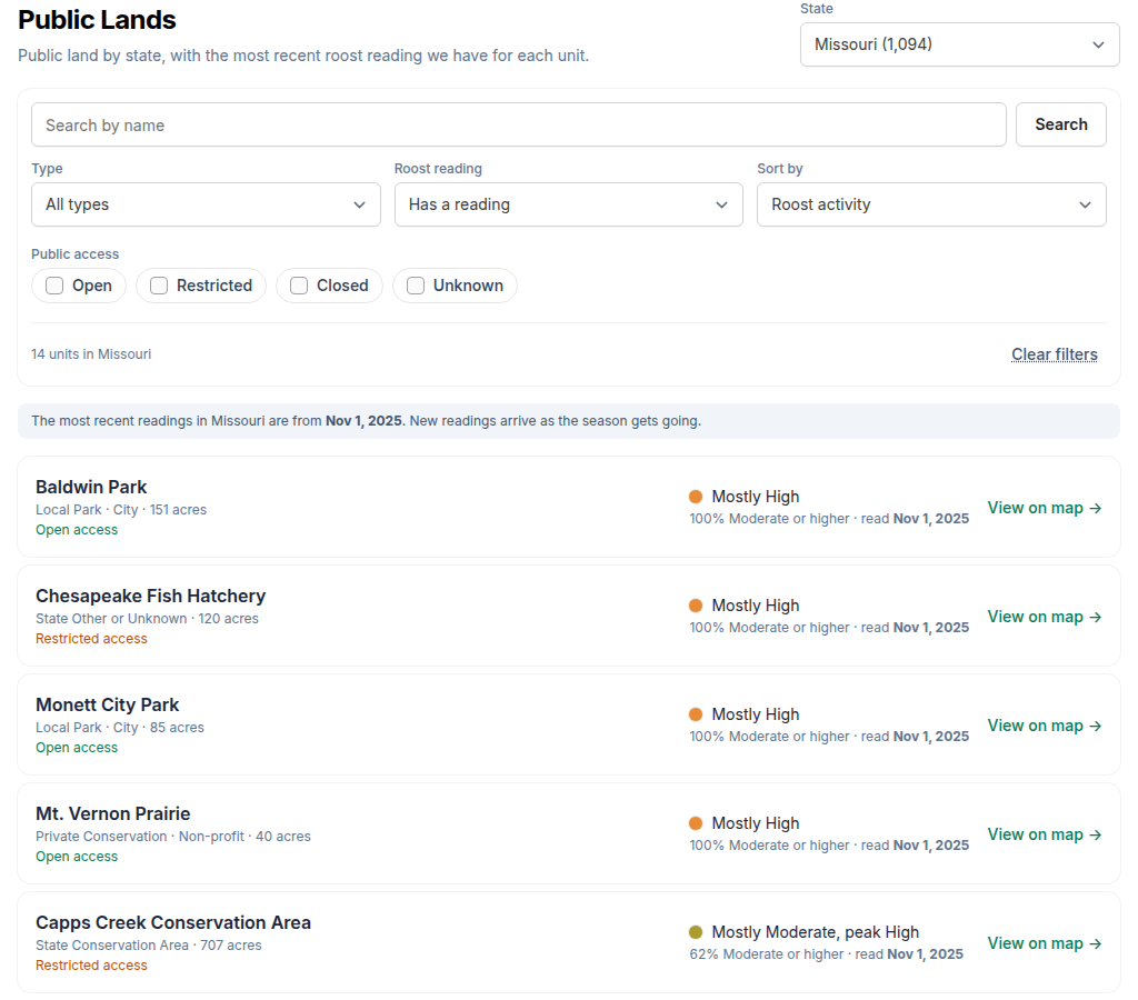
Pick a state from the State menu at the top. The number beside each state is how many units it has. The page opens on the state you looked at last, or, the first time, on the state where most of your saved spots are.
Reading a unit
Each row is one public land unit:
- Name, then its type, who manages it and its size — for example State Conservation Area · 707 acres.
- Public access — Open access, Restricted access (a permit, a season or a closure applies), Closed to public, or Access unknown.
- The reading — for example Mostly Moderate, peak High. Mostly is the level at least half the unit reached or beat; peak is its hottest part. The colour dot is the Mostly level, in the same colours as the map key.
- % Moderate or higher — how much of the unit showed a genuinely good roost night.
- read and a date — the night that reading is from.
No reading yet means FowlTracker has no roost reading for that unit so far. It is not the same as no birds.
Searching, filtering and sorting
Search by name finds units in the state whose name contains what you type — bayou, white river, refuge.
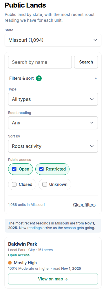
The filters narrow the list. On a phone they are folded under Filters & sort, with a badge showing how many are on.
- Type — one kind of unit, such as National Wildlife Refuge.
- Roost reading — Has a reading or No reading yet.
- Public access — tick any of Open, Restricted, Closed and Unknown.
Sort by:
- Roost activity — the strongest readings first. Units read on the most recent night come first, then units whose latest reading is older, so an old hot reading never sits above last night's.
- Name — alphabetical.
- Size — largest first.
- Most recently read — newest reading first.
Clear filters puts the list back to the whole state.
View on map
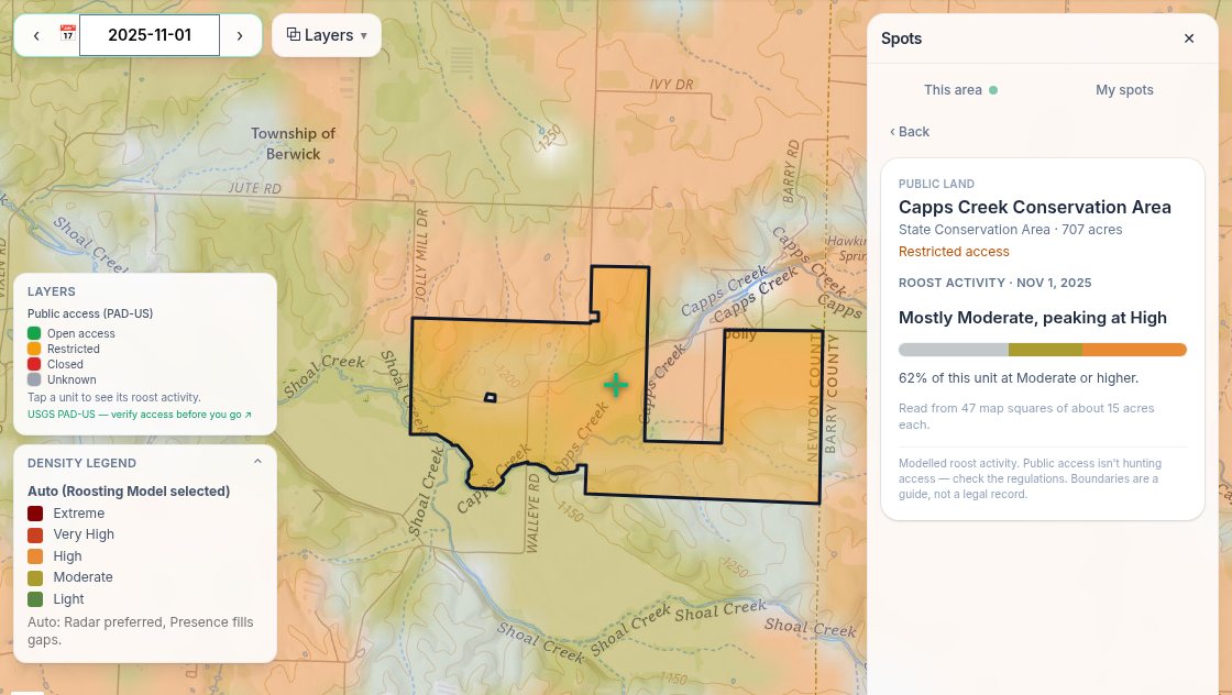
View on map opens the map centred on the unit, with the Public land layer on, the roost map showing the night of its reading, and the unit's card open in the Spots panel. The card shows the whole unit's reading as a bar of levels and how many map squares it covers. From there you can step through other dates or tap neighbouring units — see Other Map Layers.
What it is claiming
Every reading looks backward. It is modelled roost activity for a night that already happened, not a prediction that birds will be there when you go. Out of season the most recent readings can be months old, and the page says so above the list.
A reading covers the whole unit in map squares of about 15 acres, so a small unit takes on the reading of the ground around it, and one busy corner of a big refuge can sit behind a Mostly Light — check the peak.
Boundaries, managers and access come from the USGS Protected Areas Database (PAD-US). They are a guide, not a legal record, and public access isn't hunting access: confirm the regulations with the managing agency before you hunt. Some states' records are incomplete, and the list leaves out easements and units under 40 acres. Those still show on the map's Public land layer, where you can tap them for a reading.
The list is open to every plan. Roost readings, the Roost reading filter and the Roost activity and Most recently read sorts are Premium.